• 2023-01-24-o3a9884-large

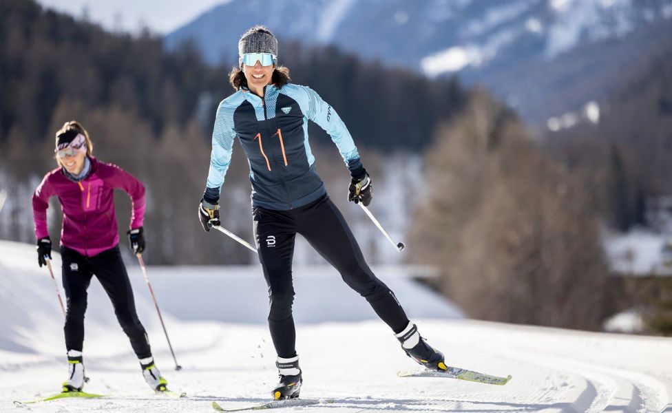
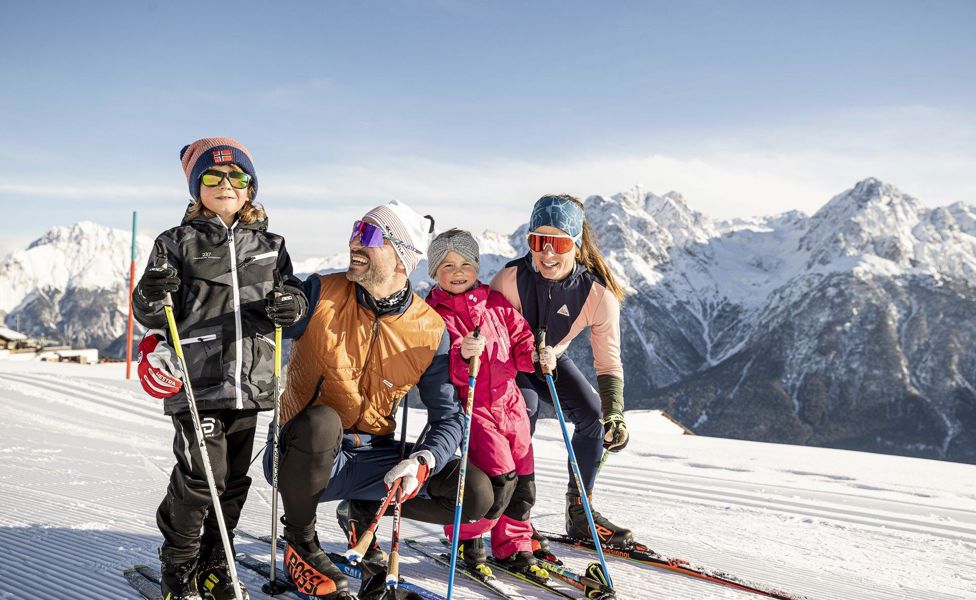
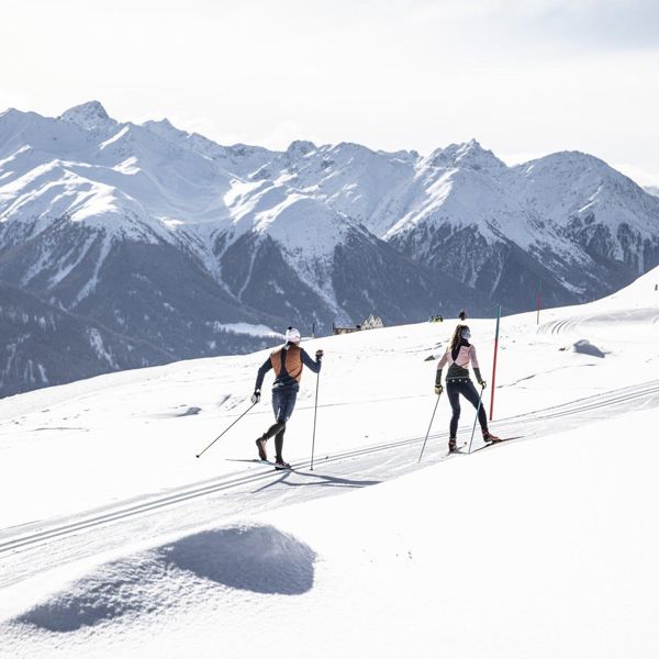
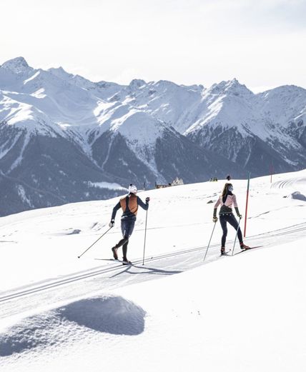
The cross-country skiing area Engadin Scuol Zernez (CH)

90 km of cross-country skiing pleasure along the Inn River

Along the dreamy landscape of the Inn river or perhaps a bit higher up on a sunny terrace?
The Lower Engadine impresses across the board with over 90 kilometers of cross-country skiing trails and offers a special experience for all cross-country skiers.

The Lower Engadine provides a diverse network of trails in the pristine nature at the foot of the Swiss National Park, most of which can be conveniently accessed by public transport such as the post bus and the Rhaetian Railway. Whether you prefer classic or skating styles, whether you're a beginner or an ambitious athlete, there's something for every taste.
Cross-country skiing trails in Engadin Scuol Zernez
Loipe Tarasp, Sgnè
Open
Scuol-Zernez
Loipe Tarasp, Sgnè
Open
Scuol-Zernez
Route length:1.281km
Ascension:78m
Defeat:78m
Altitude:1376m - 1454m
Difficulty: Easy
Tarasp
General description
Easy loop with views of Ftan and across to the Motta Naluns snow sports area.
The trail is groomed regularly when conditions are good. Please note the condition reports in the winter sports report.

The tour was assessed in favourable weather conditions, the current snow and weather conditions must be taken into account before setting off.  

Emergency call:

144 Emergency call, first aid

1414 Mountain rescue REGA

112 International emergency call
Circular trail for classic and skating.
At the bus stop Tarasp, Sgnè
On the road from Martina-Scuol-Zernez-St. Moritz, turn off at Vulpera. Follow the road towards Tarasp as far as Sgnè
By PostBus from Scuol-Tarasp, staziun to Tarasp, Sgnè
Start: Tarasp bus stop, Sgnè
Nachtloipe Ftan
Open
Scuol-Zernez
Nachtloipe Ftan
Open
Scuol-Zernez
Route length:2.24km
Ascension:49m
Defeat:49m
Altitude:1592m - 1619m
Difficulty: Medium
Lighting
Nachtloipe Ftan
General description
From the PostBus stop Ftan, cumün, the trail entrance is located towards the western end of the village, at the wooden hut next to the car park. This circuit is a shortened version of the Hochalpines Institut Ftan cross-country ski trail, but this does not detract from the skiing pleasure. Nevertheless, the short circuit has its own special charm and is also technically perfect. This circuit is particularly popular with locals. 


Important: The light switch for the night trail is located at the wooden hut by the car park (towards Ardez). After switching on, the light burns for one hour and then switches off automatically.
The trail is groomed regularly when conditions are good. Please note the condition reports in the winter sports report.

The tour was assessed in favourable weather conditions, the current snow and weather conditions must be taken into account before setting off.  

Emergency call:

144 Emergency call, first aid

1414 Mountain rescue REGA

112 International emergency call
A challenging but beautifully situated circular trail. The varied terrain is floodlit in the evening and is therefore ideal for evening training.
Paid parking in Ftan at the valley station of the Ftan-Prui chairlift
Free parking at Kinderland Sainas, at the guest information centre and at the Ftan-Pitschen entrance
From the north: via Landquart - Klosters by car transport through the Vereina Tunnel (Selfranga - Sagliains) or via the Flüela Pass to the Lower Engadine on H27
From the east: via Landeck / Austria in the direction of St. Moritz on H27
From the south: via Reschenpass (Nauders-Martina) or Ofenpass (Val Müstair-Zernez) on H27
Sent, turn off to Sur En
Take the Rhaetian Railway (from Chur, Prättigau or Upper Engadine) or the PostBus (from Martina, Sent or Tarasp) to Scuol-Tarasp station every hour.
Direct hourly PostBus connection from Scuol-Tarasp to the PostBus stop Ftan, cumün
  • From the PostBus stop Ftan, cumün approx. 300m in the direction of the western village exit
  • Kinderland Sainas
  • Hotel Paradies car park
  • Cross the road
  • U-turn 
  • Shortly through the forest
Scuol - Sur En
Open
Scuol-Zernez
Scuol - Sur En
Open
Scuol-Zernez
Route length:9.27km
Ascension:89m
Defeat:170m
Altitude:1111m - 1199m
Difficulty: Medium
LL Scuol
General description
The starting point of the trail is in Scuol. Numerous mineral water springs have turned the capital of the Lower Engadine into a wellness destination. Some of the village fountains have fresh mineral water. The old parts of the village, Scuol Sot and Scuol Sura, impress with their Romanesque architecture. The Swiss National Park, the spa and, of course, the ski area make the village a popular holiday destination. The valley trail begins at the eastern edge of the village of Scuol. It crosses the River Inn for the first time over several bends and slightly downhill. Passing the small farming village of Pradella, you reach Sur En, the gateway to the Uina Gorge. There used to be three corn mills, sawmills, lime kilns, two leather tanneries, a forge, a dye works, a roller and a cone mill here. Hard to imagine today when looking at this dreamy mini-village.
The trail is groomed regularly when conditions are good. Please note the condition reports in the winter sports report.

The tour was assessed in favourable weather conditions, the current snow and weather conditions must be taken into account before setting off.  

Emergency call:

144 Emergency call, first aid

1414 Mountain rescue REGA

112 International emergency call
The valley trail always follows the River Inn, across open terrain, through sparse forest and cosy Engadin hamlets.
Paid parking at the railway station in Scuol
Free car parks in Scuol, Serras by the cross-country ski trail
Free parking in Pradella in front of the bridge at the power station on the cross-country ski trail
Paid car parks in Sur En
  •  From the north: via Landquart - Klosters by car transport through the Vereina Tunnel (Selfranga - Sagliains) or via the Flüela Pass to the Lower Engadine on H27
    From the east: via Landeck / Austria in the direction of St. Moritz on H27
    From the south: via Reschenpass (Nauders-Martina) or Ofenpass (Val Müstair-Zernez) on H27
     Scuol is on the Engadine road H27
By Rhaetian Railway (from Chur, Landquart/Prättigau or Upper Engadine) and PostBus (from Tarasp, Sent or Ftan) to Scuol-Tarasp station
Continue by PostBus to the cross-country ski trail entrance at the PostBus stop Scuol, Serras
Start: PostBus stop Scuol, Serras
Scuol - Martina
Open
Scuol-Zernez
Scuol - Martina
Open
Scuol-Zernez
Route length:20.362km
Ascension:245m
Defeat:394m
Altitude:1037m - 1199m
Difficulty: Medium
LL Scuol
General description
The starting point of the trail is in Scuol on the eastern edge of the village. The Inn is crossed for the first time via several bends and a slight descent. Passing the small farming village of Pradella, the trail continues to Sur En, the gateway to the Uina Gorge. At Sur En - which means ‘above the Inn’ - cross-country skiers also cross the river again. Alternating between open terrain and sparse forest, the trail always stays close to the water. A total of three additional loops, some with steep intermediate sections, offer variety on the way to Martina, even for those familiar with the route. Although the border village of Martina has only around 100 inhabitants, it has two churches worth seeing: San Plasch (1515) and San Niclà (12th century). There is also the ‘Stamparia Strada’ printing museum in Strada, just before Martina. The print shop was founded in 1680 and today, after careful renovation, is one of the best-preserved farmhouses of the era.
The trail is groomed regularly when conditions are good. Please note the condition reports in the winter sports report.

The tour was assessed in favourable weather conditions, the current snow and weather conditions must be taken into account before setting off.  

Emergency call:

144 Emergency call, first aid

1414 Mountain rescue REGA

112 International emergency call
The valley trail follows the River Inn through open terrain, sparse forest and Engadin hamlets. It offers a number of entry and exit points and additional loops.
  • Paid parking spaces at the railway station in Scuol
  • Free car parks in Scuol, Serras by the cross-country ski trail
  • Free parking in Pradella in front of the bridge at the power station on the cross-country ski trail
  • Paid car parks in Sur En
  • Paid car parks in Ramosch
  • Free car parks in Strada by the cross-country ski trail
  •  From the north: via Landquart - Klosters by car transport through the Vereina Tunnel (Selfranga - Sagliains) or via the Flüela Pass to the Lower Engadine on H27
    From the east: via Landeck / Austria in the direction of St. Moritz on H27
    From the south: via Reschenpass (Nauders-Martina) or Ofenpass (Val Müstair-Zernez) on H27
     Scuol is on the Engadine road H27
By Rhaetian Railway (from Chur, Landquart/Prättigau or Upper Engadine) and PostBus (from Tarasp, Sent or Ftan) to Scuol-Tarasp station
Continue by PostBus to the cross-country ski trail entrance at the PostBus stop Scuol, Serras
Start: PostBus stop Scuol, Serras
Sur En-Ramosch
Open
Scuol-Zernez
Sur En-Ramosch
Open
Scuol-Zernez
Route length:3.714km
Ascension:93m
Defeat:38m
Altitude:1100m - 1163m
Difficulty: Medium
Sur En-Ramosch
General description
At Sur En - which means ‘over the Inn’ - cross-country skiers also cross the river and continue alternately through open terrain or sparse forest. The trail is always close to the water as far as Ramosch.
The trail is groomed regularly when conditions are good. Please note the condition reports in the winter sports report.

The tour was assessed in favourable weather conditions, the current snow and weather conditions must be taken into account before setting off.  

Emergency call:

144 Emergency call, first aid

1414 Mountain rescue REGA

112 International emergency call
The valley trail always follows the River Inn, across open terrain, through sparse forest and cosy Engadin hamlets.
Free parking in Pradella in front of the bridge at the power station on the cross-country ski trail
Paid car parks in Sur En
Paid car parks in Ramosch
From the north: via Landquart - Klosters by car transport through the Vereina Tunnel (Selfranga - Sagliains) or via the Flüela Pass to the Lower Engadine on H27
From the east: via Landeck / Austria in the direction of St. Moritz on H27
From the south: via Reschenpass (Nauders-Martina) or Ofenpass (Val Müstair-Zernez) on H27
Sent, turn off to Sur En
By Rhaetian Railway (from Chur, Landquart/Prättigau or Upper Engadine) and PostBus (from Tarasp, Sent or Ftan) to Scuol-Tarasp railway station
Continue by PostBus to the trail entrance at the PostBus stop Sent, Sur En (camping site)
Access in Sur En
Loipe Zernez, Champatsch
Open
Scuol-Zernez
Loipe Zernez, Champatsch
Open
Scuol-Zernez
Route length:2.172km
Ascension:11m
Defeat:11m
Altitude:1475m - 1485m
Difficulty: Easy
LL Zernez Champatsch
General description
The approximately 2 km long circular trail in Zernez is ideal for a leisurely cross-country skiing tour on the edge of the village of Zernez between the Spölbach stream and the edge of the forest. The Champatsch circuit starts at the wooden bridge in Prà da Punt, but can also be started at the sports and cross-country skiing centre in the middle of Zernez and combined with the night trail, circular trail and racing trail as desired.
Refreshments available at the Center da Sport restaurant with direct access to the cross-country ski trail. Cross-country ski hire directly at the trail entrance.
The trail is groomed regularly when conditions are good. Please note the condition reports in the winter sports report.

The tour was assessed in favourable weather conditions, the current snow and weather conditions must be taken into account before setting off.  

Emergency call:

144 Emergency call, first aid

1414 Mountain rescue REGA

112 International emergency call
The approximately 2 km long Champatsch trail in Zernez is an attractive and not too difficult circular trail on the banks of the Spölbach stream.
Free parking available at the Center da Sport (Urtatsch 147A)
Free parking spaces in Prà da Punt (exit Zernez direction Ofenpass)
  • From the north: via Landquart - Klosters by car transport through the Vereina tunnel (Selfranga - Sagliains) to the Lower Engadine on H27
    From the east: via Landeck / Austria in the direction of St. Moritz on H27
    From the south: via Reschenpass (Nauders-Martina) or Ofenpass (Val Müstair-Zernez) on H27
    Zernez is located directly on the Engadine road H27 (15 minutes from the Vereina south portal)
Con la Ferrovia Retica (da Coira, Landquart/Prättigau, Scuol o Alta Engadina) ogni ora fino a Zernez
Zernez railway station, trail entrance at the western end of the village or Zernez sports and cross-country centre in the middle of the village.
night cross-country ski run Zernez
Open
Scuol-Zernez
night cross-country ski run Zernez
Open
Scuol-Zernez
Route length:3.287km
Ascension:44m
Defeat:44m
Altitude:1475m - 1517m
Difficulty: Easy
Lighting
Nachtloipe Zernez
General description
The 3.3 km long and floodlit circular trail consists of two loops. The first leads from the sports centre out onto a plain in the direction of Prà da Punt (about 1 km). You then cross the Spölbach stream and can tackle the second loop. This leads over a short but intense ramp up to the edge of the forest where you then head back towards Zernez and, after a rapid descent, back to the starting point. (The lighting can be switched on manually).
The trail is groomed regularly when conditions are good. Please note the condition reports in the winter sports report.

The tour was assessed in favourable weather conditions, the current snow and weather conditions must be taken into account before setting off.  

Emergency call:

144 Emergency call, first aid

1414 Mountain rescue REGA

112 International emergency call
The 3.3 km long and floodlit circular trail in Zernez is ideal as a short training trail for those in training or for a leisurely round after sunset.
Paid parking at the railway station in Zernez
Free car park in Prà da Punt (end of Zernez towards Ofenpass)
Free parking at the Centre da Sport (Urtatsch 147A)
From the north: via Landquart - Klosters by car transport through the Vereina Tunnel (Selfranga - Sagliains) or via the Flüela Pass to the Lower Engadine on H27
From the east: via Landeck / Austria in the direction of St. Moritz on H27
From the south: via Reschenpass (Nauders-Martina) or Ofenpass (Val Müstair-Zernez) on H27
Zernez and Susch are located directly on the Engadine road H27 (5-15 minutes from the Vereina south portal)
With the Rhaetian Railway (from Chur, Landquart/Prättigau, Scuol or Upper Engadine) hourly to Zernez
Zernez railway station or Center Parc Naziunal bus stop, trail entrance at the Zernez sports centre in the centre of the village
Biathlon Sclamischot
Open
Scuol-Zernez
Biathlon Sclamischot
Open
Scuol-Zernez
Route length:4.053km
Ascension:64m
Defeat:64m
Altitude:1038m - 1076m
Difficulty: Medium
Biathlon
General description
The trails are racing trails that meet international IBU standards. Ambitious cross-country skiers will find a variety of well-groomed trails in both free and classic technique. Beginners can also tackle a 1 km circular trail in the area without any major technical challenges. 2 km of the trail are floodlit.
The trail is groomed regularly when conditions are good. Please note the condition reports in the winter sports report.

The tour was assessed in favourable weather conditions, the current snow and weather conditions must be taken into account before setting off.  

Emergency call:

144 Emergency call, first aid

1414 Mountain rescue REGA

112 International emergency call
The newly renovated biathlon shooting range in Sclamischot is the only biathlon facility in the Lower Engadine. It has a selection of circular trails up to 4 km.
  • Car park available in Sclamischot
  • From the north: via Landquart - Klosters by car transport through the Vereina Tunnel (Selfranga - Sagliains) or via the Flüela Pass to the Lower Engadine on H27
  • From the east: via Landeck / Austria in the direction of St. Moritz on H27
  • From the south: via Reschenpass (Nauders-Martina) or Ofenpass (Val Müstair-Zernez) on H27
  • Strada, turn off over the bridge to Sclamischot
  • Take the Rhaetian Railway (from Chur, Landquart/Prättigau or Upper Engadine) and PostBus (from Tarasp, Sent or Ftan) to Scuol-Tarasp station
  • Continue by PostBus to the stop Strada i. E., Sclamischot
  • 500 metres to the biathlon facility
Cross the wooden bridge to Sclamischot. The trail connection for experienced skiers is immediately after the bridge. For beginners, we recommend walking 200 metres to the left after the bridge through the industrial zone and using the trail connection on the right-hand side in the area.
Lavin - Giarsun
Open
Scuol-Zernez
Lavin - Giarsun
Open
Scuol-Zernez
Route length:2.939km
Ascension:83m
Defeat:56m
Altitude:1378m - 1416m
Difficulty: Medium
Lavin
General description
The trail starts at the Inn bridge in Lavin and takes you past a small wooded area. The trail then runs in the direction of Giarsun until before the Inn bridge, where the trail makes a loop and leads back to Lavin.
The trail is groomed regularly when conditions are good. Please note the condition reports in the winter sports report.

The tour was assessed in favourable weather conditions, the current snow and weather conditions must be taken into account before setting off.  

Emergency call:

144 Emergency call, first aid

1414 Mountain rescue REGA

112 International emergency call
Second section of the trail from Susch to Giarsun. Starting in Lavin, the trail runs along the Inn to just before Giarsun and then back to Lavin.
  • Paid parking spaces at the railway station in Lavin
  • From the north: via Landquart - Klosters by car transport through the Vereina Tunnel (Selfranga - Sagliains) or via the Flüela Pass to the Lower Engadine on H27
  • From the east: via Landeck / Austria in the direction of St. Moritz on H27
  • From the south: via Reschenpass (Nauders-Martina) or Ofenpass (Val Müstair-Zernez) on H27
  • Lavin is located directly on the Engadine road H27 (5-15 minutes from the Vereina south portal)
With the Rhaetian Railway (from Chur, Landquart/Prättigau, Scuol or Upper Engadine) hourly to Lavin
Access in Lavin
Loipe Motta Naluns
Open
Scuol-Zernez
Loipe Motta Naluns
Open
Scuol-Zernez
Route length:2.401km
Ascension:164m
Defeat:164m
Altitude:2122m - 2286m
Difficulty: Easy
Motta Naluns
General description
High plateau with easy ascents and easy descents in the Motta Naluns ski area. Panoramic views of the Lower Engadine Dolomites and Val S-charl.
The trail is groomed regularly when conditions are good. Please note the condition reports in the winter sports report.

The tour was assessed in favourable weather conditions, the current snow and weather conditions must be taken into account before setting off.  

Emergency call:

144 Emergency call, first aid

1414 Mountain rescue REGA

112 International emergency call
2.5 km high-altitude / panoramic trail for classic and skating on Motta Naluns (circular trail).
Paid parking spaces available at the cable car Scuol
  •  From the north: via Landquart - Klosters by car transport through the Vereina Tunnel (Selfranga - Sagliains) or via the Flüela Pass to the Lower Engadine on H27
    From the east: via Landeck / Austria in the direction of St. Moritz on H27
    From the south: via Reschenpass (Nauders-Martina) or Ofenpass (Val Müstair-Zernez) on H27
     Scuol is on the Engadine road H27
  • By Rhaetian Railway (from Chur, Landquart/Prättigau or Upper Engadine) and PostBus (from Tarasp, Sent or Ftan) to Scuol-Tarasp station
From the Motta Naluns mountain station, walk in the direction of Prui to the start of the cross-country ski trail.
Ramosch - Martina
Open
Scuol-Zernez
Ramosch - Martina
Open
Scuol-Zernez
Route length:9.325km
Ascension:95m
Defeat:223m
Altitude:1036m - 1163m
Difficulty: Medium
Ramosch - Martina
General description
From Ramosch, the trail alternates between open terrain and sparse forest and always remains close to the water. A total of three additional loops, some with steep intermediate sections, offer variety on the way to Martina, even for those familiar with the route. Although the border village of Martina has only around 100 inhabitants, it has two churches worth seeing: San Plasch from 1515 and San Niclà (12th century) with a monumental painting of St Christopher. There is also the ‘Stamparia Strada’ printing museum in Tschlin, just before Martina. The print shop was founded in 1680. Following careful renovation, the house is now one of the best-preserved farmhouses of the era and is a sight in itself.
The trail is groomed regularly when conditions are good. Please note the condition reports in the winter sports report.

The tour was assessed in favourable weather conditions, the current snow and weather conditions must be taken into account before setting off.  

Emergency call:

144 Emergency call, first aid

1414 Mountain rescue REGA

112 International emergency call
The valley trail always follows the River Inn, across open terrain, through sparse forest and cosy Engadin hamlets.
  • Paid car parks in Ramosch
  • Free car park in Strada near the cross-country ski trail
  •  From the north: via Landquart - Klosters by car transport through the Vereina Tunnel (Selfranga - Sagliains) or via the Flüela Pass to the Lower Engadine on H27
  • From the east: via Landeck / Austria in the direction of St. Moritz on H27
  • From the south: via Reschenpass (Nauders-Martina) or Ofenpass (Val Müstair-Zernez) on H27
  • Ramosch is on the Engadine road H27
  •  By Rhaetian Railway (from Chur, Landquart/Prättigau or Upper Engadine) and PostBus (from Tarasp, Sent or Ftan) to Scuol-Tarasp railway station
  • Continue by PostBus to the cross-country ski trail entrance at the PostBus stop Ramosch, Fermada 
Access at the PostBus stop Ramosch, Fermada
Information and service
2023-01-24-o3a9884-large
Vacation planning
Accomodation for your cross-country ski holiday in Engadin Scuol Zernez